Article Title
Abstract or Description
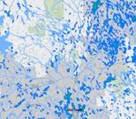
This map illustrates the water resources of Maine in the context of human presence and protected areas, the emphasis placed on wetlands. Wetlands, rivers, streams, ponds and lakes are projected onto layers showing population density on a logarithmic scale and the conservation lands of Maine. A hill shade layer is also displayed on the map to provide a backdrop for the topography surrounding the displayed water resources.
Source Data Note
Data for this map was gathered from the Maine Office of GIS (http://megis.maine.gov/catalog/catalog.asp), the US Fish and Wildlife Service National Wetland Inventory at (http://megis.maine.gov/catalog/catalog.asp), the US Census Bureau at (http://www.census.gov/) and from ESRI, Inc. v9.3. Projection: Universal Transverse Mercator, North American Datum 1983 Zone 19N.
Rights
Recommended Citation
Bittler, Kimberly ('11) "Wetlands, Conservation Lands and Population of Maine," Atlas of Maine: Vol. 2009: No. 1, Article 4.Available at: https://digitalcommons.colby.edu/atlas_docs/vol2009/iss1/4