Abstract or Description
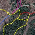
I created an updated map of trails at Colby College using global positioning system data that were then edited in ArcGIS. The map background, obtained from the Maine Office of GIS, was created from digital orthophotographs produced from aerial photos collected over southwest Maine in Spring 2003. Trail difficulty was determined by creating a slope layer and taking other factors into consideration such as ground surface and path width. The map will eventually be available online, enabling interactive selection of trails where users can access additional trail information.
Rights
Recommended Citation
Rolleri, Jacqueline ('05) "Spatial Analysis of Colby College Trails: Perkins Arboretum and Runnals Hill," Atlas of Maine: Vol. 2006: No. 2, Article 7.Available at: https://digitalcommons.colby.edu/atlas_docs/vol2006/iss2/7
COinS