Article Title
Abstract or Description
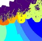
This map shows one option for a viable energy source that is clean, free and endless: wind power. This map shows that the coast of Maine has the potential space and wind speed to be a location for wind farms. Four NOAA buoys placed in different locations along the Maine coast are the source of the wind speed data for this project. The average wind speed of every ten minutes of every day for the year 2004 were averaged so that each buoy was represented by one number of wind speed measured in meters/ second. The values in between these four buoys were estimated, or interpolated, using ArcGIS. Other factors that I took into consideration during this lab were distance from airports (no wind farm can be with in a three mile radius of an airport ) and distance from counties (no one wants an offshore wind farm that obstructs their view). I calculated the most appropriate locations for a wind farm in ArcGIS, by adding these three layers. The final output shows an area along Mt. Desert to be the most appropriate for development.
Rights
Recommended Citation
Newbury, Sophia S. ('08) "Wind Power Suitability Analysis for the Gulf of Maine," Atlas of Maine: Vol. 2005: No. 2, Article 4.Available at: https://digitalcommons.colby.edu/atlas_docs/vol2005/iss2/4