Abstract or Description
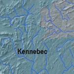
The Relationship Between Watershed Boundaries and Elevation in Maine was created using watershed, river, and elevation data from the Maine Office of GIS. It shows how elevation has helped shape major watersheds in the state.
Source Data Note
Data provided by Maine Office of GIS.
Rights
Recommended Citation
Chamberlin, Caitlin ('05) "The Relationship Between Watershed Boundaries and Elevation in Maine," Atlas of Maine: Vol. 2005: No. 1, Article 1.Available at: https://digitalcommons.colby.edu/atlas_docs/vol2005/iss1/1
COinS