Article Title
Abstract or Description
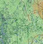
The Wildlife Habitat of Maine map was created using data from the Maine Office of GIS and the United States National Atlas. The map shows the land cover characteristics of Maine, including human development and major roads. The most suitable wildlife habitat can be attributed to the areas with the most suitable land cover and the least human development. An inset map shows overall habitat values for 91 priority trust species of the U.S. Fish & Wildlife Service, within forested cover types.
Source Data Note
Data from the Maine Office of GIS and the United States National Atlas.
Rights
Recommended Citation
Sicard, Wendy ('05) "Wildlife Habitat of Maine," Atlas of Maine: Vol. 2005: No. 1, Article 11.Available at: https://digitalcommons.colby.edu/atlas_docs/vol2005/iss1/11
COinS