Article Title
Abstract or Description
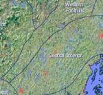
The Biophysical Regions of Maine map was created using land cover data from the Maine office of GIS. This data layer, combined with a hillshade layer, demonstrates some of the biophysical features that contribute to the categorization of the 15 different biophysical regions of the state of Maine.
Source Data Note
Map created using ArcGIS. Projected with NAD 1983, Univeral Transverse Mercator Projection, Zone 19N. Data provided by Maine Office of GIS (http://megis.maine.gov) and ESRI 9.3.
Rights
Recommended Citation
Balazs, Emma ('09) "Biophysical Regions of Maine," Atlas of Maine: Vol. 2009: No. 1, Article 3.Available at: https://digitalcommons.colby.edu/atlas_docs/vol2009/iss1/3
COinS