Article Title
Abstract or Description
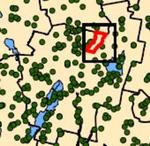
This map showing locations of public water supplies in Maine was created in ArcGIS 9.1 using data downloaded from the Maine Office of GIS. The map shows point locations of groundwater wells, areas of surface water supplies, and areas of groundwater well buffers.
Source Data Note
All data were downloaded from the Maine Office of GIS website (http://apollo.ogis.state.me.us/catalog/) and projected in NAD_83 UTM coordinate zone 19N.
Rights
Recommended Citation
Prisby, Karen ('07) "Maine Public Water Supplies," Atlas of Maine: Vol. 2006: No. 1, Article 10.Available at: https://digitalcommons.colby.edu/atlas_docs/vol2006/iss1/10
COinS