Article Title
Abstract or Description
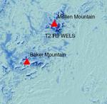
Data were downloaded from the Web site of the National Renewable Energy Laboratory of the United States Department of Energy. It was produced by True Wind Solutions and shows the areas in Maine where it would be viable to undergo wind power projects.
Source Data Note
This map was projected with UTM Zone 19 NAD83. The source data for the towns, summits, and hillshade were obtained from the Maine Office of GIS. The Wind Power Class layer and information was obtained from the National Renewable Energy Laboratory.
Rights
Recommended Citation
Capponi, Randa ('06) "Average Annual Wind Resource Potential in Maine," Atlas of Maine: Vol. 2006: No. 1, Article 1.Available at: https://digitalcommons.colby.edu/atlas_docs/vol2006/iss1/1
COinS