Article Title
Abstract or Description
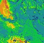
Fire is a major management issue in the southwestern United States. Three spatial models of fire risk for Coconino County, Northern Arizona. These models were generated using thematic data layers depicting vegetation, elevation, wind speed and direction, and precipitation for January (winter), June (summer), and July (start of monsoon season). ArcGIS 9.0 was used to weight attributes in raster layers to reflect their influence on fire risk and to interpolate raster data layers from point data. Final models were generated using the raster calculator in the Spatial Analyst extension of ArcGIS 9.0. Ultimately, the unique combinations of variables resulted in three different models illustrating the change in fire risk during the year.
Rights
Recommended Citation
Dunham, Sarah ('05) "Fire Hazard in Coconino County, Arizona," Atlas of Maine: Vol. 2005: No. 2, Article 10.Available at: https://digitalcommons.colby.edu/atlas_docs/vol2005/iss2/10
COinS