Abstract or Description
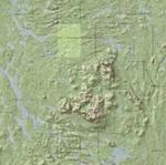
The USGS Topographic Maps Over a Hillshaded Digital Elevation Model was created using ArcGIS 9.0. U.S. Geologic Survey 7.5 minute topographic maps at a scale of 1:24 000 for the entire state of Maine were placed over a hillshaded digital elevation model for the entire state of Maine. The topographic maps were set at 40% transparency to allow elevational features to be more pronounced.
Source Data Note
Data obtained from the Maine Office of GIS, USGS 7.5 minute topographic maps (1:24 000) of Maine (DRG layer) at 40% transparency over a 30 meter hillshaded digital elevation model (MEDEM30 layer) for the entire state. Projection: NAD 1983 UTM zone 19 N. Interactive map is not available for this project.
Rights
Recommended Citation
Mehlich, Rob ('05) "USGS Topographic Maps over a Hillshaded Digital Elevation Model," Atlas of Maine: Vol. 2005: No. 1, Article 8.Available at: https://digitalcommons.colby.edu/atlas_docs/vol2005/iss1/8
COinS